Soil erosion is a significant environmental issue that impacts the fertility and productivity of agricultural lands. It occurs when soil particles are displaced by water, wind, or other forces. The removal of soil not only results in the loss of essential nutrients but can also lead to long-term environmental degradation.
Runoff and Its Role in Soil Erosion
Runoff refers to the excess water from rainfall that does not infiltrate the soil but flows over the surface, eventually reaching rivers, lakes, or oceans. The extent and intensity of runoff can greatly influence soil erosion, particularly in areas with poor vegetation cover or in highly compacted soils. The formula for calculating runoff is as follows:
Runoff = Rainfall – [Infiltration + Interception + Surface Storage + Surface Detention]
Factors affecting runoff can be grouped into climatic, physiographic, and geological categories.
Factors Affecting Runoff:
(A) Climatic Factors:
- Rainfall Characteristics: The amount, intensity, and duration of rainfall are key drivers of runoff and soil erosion. High-intensity rainfall (>5 cm/hr) can result in severe erosion.
- Snowfall: In regions where snowfall occurs, the melting snow can contribute to surface runoff, particularly if the thaw is rapid.
- Evapo-transpiration: The amount of water lost through evaporation and plant transpiration also affects the amount of water available for runoff.
(B) Physiographic Factors:
- Watershed Characteristics: The topography of the soil, soil type, orientation, vegetation cover, and the size of the watershed play a role in water movement and retention.
- Channel Characteristics: The size, slope, and roughness of water channels (streams, rivers) determine the rate at which water flows and its capacity to transport eroded soil.
(C) Geological Factors:
- Lithological, Structural, and Hydrological Characteristics: The permeability, porosity, and transmissivity of the soil affect how much water infiltrates the ground versus how much flows as runoff.
Soil Erosion Mechanisms: Soil erosion is classified into two major types based on the forces involved: water erosion and wind erosion.
Water Erosion:
Water erosion occurs when rainfall or surface runoff displaces soil particles, leading to the loss of soil fertility. The Universal Soil Loss Equation (USLE) is used to estimate the amount of soil erosion caused by water. The equation is:
A = RKLSCP
Where:
- A = Predicted soil loss (tons/acre/year)
- R = Rainfall and runoff factor
- K = Soil erodibility factor
- L = Slope length
- S = Slope gradient (steepness)
- C = Soil cover and management factor
- P = Erosion control practice factor
Wind Erosion:
Wind erosion occurs in areas where dry soil is easily lifted and transported by strong winds. The Soil Loss Equation due to Wind Erosion is:
E = IRKFCWDB
Where:
- E = Soil loss due to wind erosion
- I = Soil cloddiness factor
- R = Surface cover factor
- K = Surface roughness factor
- F = Soil textural class factor
- C = Local wind factor
- W = Field width factor
- D = Wind direction factor
- B = Wind barrier factor
Soil Conservation Measures
Soil conservation is crucial for preventing soil erosion, maintaining soil fertility, and ensuring sustainable land use. The primary goal is to preserve soil against deterioration by using it within its capabilities and applying necessary conservation practices.
Fundamental Principles of Soil Conservation:
- Land Use Based on Capability: Crops must be suited to the land’s characteristics and water availability.
- Soil and Moisture Conservation: Protecting the soil and managing moisture effectively to prevent erosion.
- Best Soil Management Practices: Includes crop rotation, correction of soil acidity/alkalinity, and proper drainage.
Land Capability Classification
Soil conservation requires the classification of land based on its ability to support agricultural activities. This is generally divided into two categories: lands suitable for cultivation and lands not suitable for cultivation.
Lands Suitable for Cultivation:
- Class I: No limitations, ideal for intensive crop cultivation (e.g., alluvial soils).
- Class II: Moderate limitations; crops need to be chosen based on specific factors like slope and soil depth (e.g., red and black soils).
- Class III: Severe limitations; requires special conservation measures, including improved soil fertility and erosion control (e.g., shallow red soils).
- Class IV: Very severe limitations; only occasional cultivation is possible, best used for pastures or forestry.
Lands Not Suitable for Cultivation:
- Class V: Limitations from stream flow, short growing season, or rocky soils, suitable for grazing or forestry.
- Class VI: Moderate limitations for grazing or forestry.
- Class VII: Severe limitations restricting use to grazing or woodland.
- Class VIII: Extremely rough land, unsuitable for cultivation, used for recreation, wildlife, or watershed protection.
Agronomic Measures for Soil Conservation
Agronomic measures are techniques that help in reducing soil erosion, improving soil structure, and enhancing water retention. These measures are particularly effective when the land slope is less than 2%, and the erosion issues are not severe. The key objective of agronomic measures is to improve the soil’s ability to retain water and nutrients, thus preventing erosion and maintaining fertility. Below are the main agronomic practices used for soil conservation:
- Contour Cultivation
- Definition: Cultivating crops along the contours of the land slope (across the slope, not along it).
- Advantages:
- Soil and Water Conservation: Reduces water runoff by breaking the slope, allowing water to be absorbed more effectively.
- Soil Fertility: Helps maintain soil structure and nutrients.
- Efficiency: Requires less power and time, with less wear and tear on equipment.
- Increased Crop Yield: Improved soil retention and better water availability can lead to higher crop yields.
- Disadvantages:
- Establishing contour farming on uneven land can be labor-intensive and difficult.
- Mulching
- Definition: Applying a layer of material (natural or artificial) on the soil surface to conserve moisture, prevent erosion, and improve soil health.
- Effects of Mulching:
- Water Conservation: Reduces evaporation and promotes water infiltration.
- Soil Temperature Regulation: Helps maintain consistent soil temperature by shielding it from direct radiation.
- Weed Control: Prevents weed growth by blocking sunlight.
- Soil Nutrient Improvement: Increases organic matter, which improves soil fertility.
- Soil Structure: Improves soil porosity and structure, aiding root penetration and water retention.
- Soil Erosion Control: Protects the soil from the direct impact of raindrops, reducing erosion.
- Types of Mulches:
- Soil Mulch: A thin layer of loose, dry soil that helps reduce evaporation, especially in arid conditions.
- Stubble Mulch: Crop residues like straw left on the soil surface to conserve moisture and protect from erosion.
- Straw Mulch: Using straw to cover the soil and retain moisture.
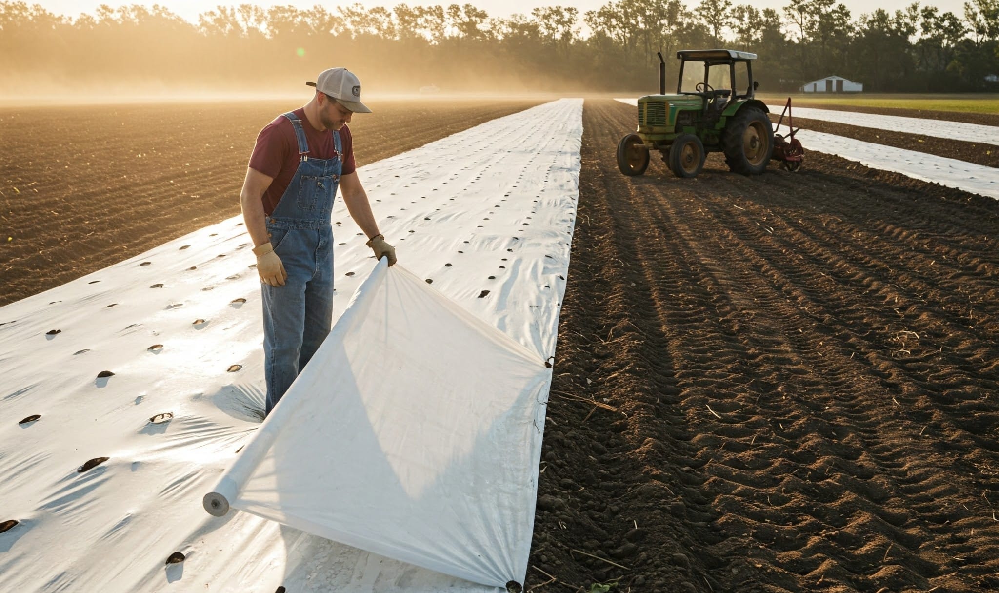
- Plastic Mulch: Polyethylene or other plastic films used to cover the soil, especially in horticulture.
- Vertical Mulching: Involves digging narrow trenches and placing organic material in them to improve water penetration, common in coffee plantations.
- Strip Cropping
- Definition: Growing different crops in alternating strips across the slope, ensuring that soil-resisting crops (like grasses or legumes) alternate with erosion-permitting crops (like cereals).
- Types of Strip Cropping:
- Contour Strip Cropping: Growing erosion-resistant crops (e.g., grasses) across the slope along the contour lines, alternating with crops prone to erosion. This system helps reduce slope length, slows down runoff, and enhances water absorption.
- Field-Strip Cropping: Crops are grown in strips across uniform slopes (not on contour lines). This system is suitable for lands with high infiltration rates.
- Wind Strip Cropping: Tall, wind-resistant crops (e.g., maize or jowar) are grown in strips to control wind erosion. This system focuses on managing wind direction rather than water erosion.
- Permanent or Temporary Buffer Strip Cropping: This method involves planting perennial grasses or legumes as buffer strips between or below cultivated fields. These strips help in stabilizing slopes and controlling erosion, particularly on steep or highly eroded areas.
- Benefits of Strip Cropping:
- Reduces the risk of erosion by breaking the slope and preventing long uninterrupted flow of water or wind.
- Helps maintain soil fertility through crop rotation and diverse plantings.
Mechanical Measures for Soil and Water Conservation
Mechanical measures are adopted to supplement agronomical practices, particularly when the land slope is more than 2%. The primary objectives of these measures are:
- To increase the time of concentration by intercepting runoff and providing an opportunity for water infiltration.
- To divide a long slope into several short ones to reduce runoff velocity and prevent erosion.
Types of Mechanical Measures
- Basin Listing
- Involves making small interrupted basins along the contour.
- Effective on retentive soils with mild slopes.
- Sub-soiling
- Breaking the hardpan using a sub-soiler at depths of 30-60 cm.
- Suitable for arid areas with high infiltration and permeability.
- Recommended for slopes of about 6%.
- Spacing between bunds should not exceed 150 cm vertical drop or 67.5 cm horizontal spacing.
- Graded Bunding / Channel Terraces
- Recommended where rainwater is not readily absorbed due to high rainfall or low soil intake.
- Suitable for areas receiving more than 800 mm of annual rainfall.
- Used in clay soils even with rainfall below 800 mm/year.
- Two types:
- Narrow-based bunding
- Broad-based bunding (for tractor-based farming)
- Suitable for lands with slopes between 2-10%.
- Extensively used in India.
- Broad Bed and Furrow (BBF) System
- Suitable for managing rainwater in black soils.
- Helps in surface drainage during the monsoon period.
- Bench Terracing
- Practiced on slopes ranging from 16-33%.
- Used on steep and undulating lands where intensive farming is possible only with bench terraces.
- Vertical drop varies from 60 to 180 cm, depending on slope and soil conditions.
- Zing Terracing
- Adopted for lands with 3-10% slopes.
- Constructed in medium to deep soils in moderate to high rainfall areas.
- Ensures adequate drainage during heavy rainfall and benefits crops grown in lower areas.
Conservation Measures for Hilly Slopes
- Contour Trenching and Afforestation
- Trenches are made along contours or uniform levels for soil and moisture conservation.
- Used in both high and low rainfall conditions.
- Effective for soil types of varying depths.
- Trench dimensions: 60 cm to 48 cm.
- Spacing: 10 to 30 m.
- Half of the excavated soil is refilled diagonally, and the remaining soil forms the spoil bank.
- Not advisable when the slope exceeds 20%.
- Bench Terracing in Hilly Areas
- Series of platforms along contours, cut into a hill slope in a step-like formation.
- Converts long slopes into small protected platforms for farming.
- Suitable for irrigated fields or orchard plantations.
- Common in Himachal Pradesh, Jammu & Kashmir, Uttarakhand, Assam, and other eastern states.
- Reduces slope length and gradient.
- Adopted for slopes up to 15% but can be used for slopes up to 33% where soil depth allows cutting and filling.
Types of Bench Terraces:
- According to Purpose:
- Hill-type bench terraces: Reverse slope towards the hill.
- Irrigated bench terraces: Level benches for irrigation, suitable for slopes up to 8%.
- Orchard bench terraces: Narrow width (~1 m) terraces for individual trees.
- Gradual bench terracing: Formation of bench terraces over time.
- According to Slope and Rainfall Conditions:
- Bench terraces sloping outward: Used in low rainfall areas (<750 mm) with permeable soils.
- Bench terraces sloping inward (Hill-type): Used in high rainfall areas (>750 mm), with poor soil infiltration.
- Level bench terraces (Table-top terraces): Used in medium rainfall areas with highly permeable soils and irrigation facilities (e.g., rice cultivation).
- Stone Terracing / Stone Wall Terraces
- Small embankments constructed with stones across slopes.
- Suitable for any slope with spacing between 10 to 30 m, depending on slope conditions.